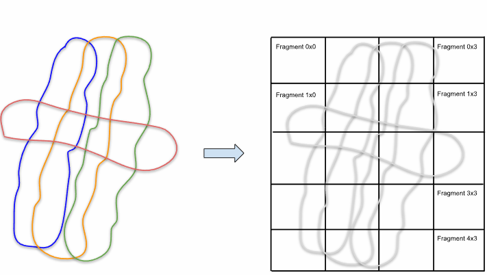
The purpose of this tools is the spatially sorting of points. In many cases, points are arranged randomly or - as in airborne laser survey, the points are aligned line wise due to the rotating laser beam. This can yield in huge data arrays inconveniently for further processing and no additional information about neighbouring fragments. With point cloud tiling provides all these information (see also Fig. 1)
|
|
| Fig.1 Conversion from unsorted strips to a regularly tiled point cloud |
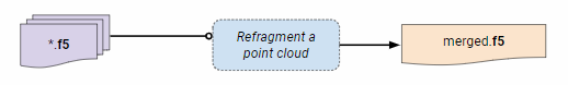
Merge Files If multiple files are loaded those files will be merged internally to a single file, followed by a point cloud tiling.
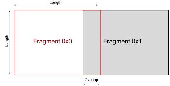
Tiling Length: This is the length as shown in Fig. 2 . If zero tile length is automatically calculated
Minimum Point Number: Tile is rejected if point number is too low
|
| Fig. 2 Tiling Length |